Explore the Industry’s Most Complete Pipeline Inspection Solution
From the Field to the Office, Our solutions Help You Do More.
SmartVision brings FieldVision and CoreVision together into one connected solution for managing inspections from the field to the office.
SmartVision brings FieldVision and CoreVision together into one connected solution for managing inspections from the field to the office. Crews collect accurate data on-site, while built-in tools assist in flagging critical insights as work is completed. Meanwhile, office teams can monitor progress, analyze results, and prioritize follow-up and capital planning—ensuring alignment, accountability, and efficiency across every project.
AiDetect accelerates inspection workflows by combining AI-powered automation with expert human oversight.
AiDetect accelerates inspection workflows by combining AI-powered automation with expert human oversight. It helps teams process more footage in less time—cutting coding and QA by at least 50%, while maintaining 97% defect detection accuracy. With standardized, NASSCO-compliant outputs that integrate directly into your existing systems, AiDetect reduces rework, simplifies reporting, and delivers the reliable data you need for proactive maintenance planning and confident budget justification.
CoreVision gives teams instant access to inspection data, maps, and reports from any location.
CoreVision gives teams instant access to inspection data, maps, and reports from any location—no software install required. It streamlines oversight, makes it easy to monitor progress, and supports fast, informed decisions. With powerful tools for reviewing, filtering, and exporting results, you can prioritize work, manage resources, and plan capital improvements with confidence.
FieldVision empowers crews to complete inspections and collect accurate data in the field, even without connectivity.
FieldVision empowers crews to complete inspections and collect accurate data in the field, even without connectivity. As work is performed, built-in tools highlight critical insights—making it easy to identify defects, track operator progress, and pinpoint important patterns that guide next steps and key decision-making.
Solutions that Meet You Where You Work


Why Teams Trust ITpipes

97% defect detection accuracy with NASSCO-compliant coding and reporting
Reduces inspection coding and QA time by at least 50%

Process up to 2x more footage without adding staff

Sole wastewater solutions provider recognized as an Esri Gold Partner

20+ years powering inspection programs across North America
Emergency repair costs cut by 30% with proactive planning
See What Municipalities and Contractors Love About ITpipes
Our Trusted Integration Partners


Check Out Our Recent Blog
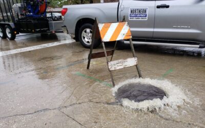
SSO Emergency Response: What Separates a Compliant Reaction From an Effective One
No prevention program eliminates the possibility of a sanitary sewer overflow. Pipe failures, extreme weather, blockages from illegal dumping, and equipment malfunctions occur even in well-maintained systems. As the first blog in this series laid out, the relevant question for a utility is not whether an SSO could happen. It is whether the organization is prepared to respond when one does. Continue Reading SSO Emergency Response: What Separates a Compliant Reaction From an Effective One

ITpipes and Novotx Launch Integration Connecting Pipe Inspection Data to Enterprise Asset and Capital Planning
New connection between ITpipes and Novotx Elements XS gives wastewater and stormwater agencies a direct path from field condition data to maintenance, rehabilitation, and long-term capital planning. Continue Reading ITpipes and Novotx Launch Integration Connecting Pipe Inspection Data to Enterprise Asset and Capital Planning
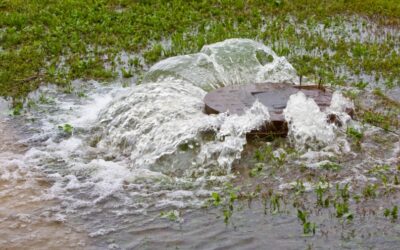
Sanitary Sewer Overflows: What They Cost, What Causes Them, and Where Your Next One Is Hiding
Most sewer systems go unnoticed until something goes wrong. The infrastructure runs underground, the maintenance happens quietly, and the public rarely thinks about where wastewater goes once it leaves a building. Continue Reading Sanitary Sewer Overflows: What They Cost, What Causes Them, and Where Your Next One Is Hiding
Want to See ITpipes in Action?
")