ITpipes and Cityworks Integration
ITpipes and Cityworks Integration provides benefits that fully and automatically integrate your asset management system with your pipe inspection planning and prioritizing. Learn more about Cityworks here.
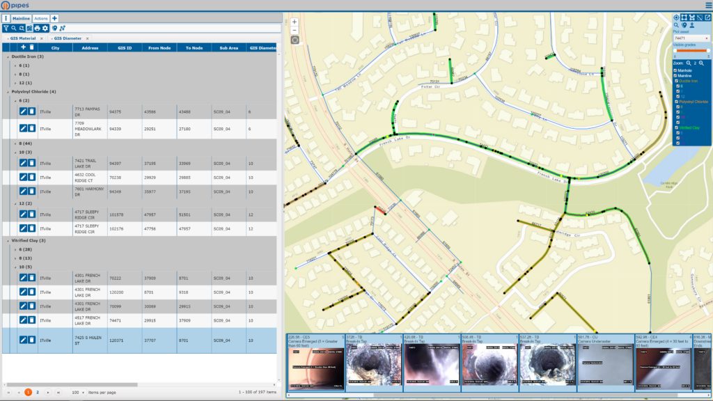
If updating your GIS attribute data with new information takes days or never gets done, check out the ITpipes and Cityworks Integration. ITpipes tools provide attribute data discrepancy review in seconds. And preferred updates can be applied in minutes, ensuring your GIS and Infor have the latest up-to-date asset information! (Only for users with ESRI user permissions for editing.)
Easily manage spatial adjustments by performing the survey, updating the GIS, and adjusting asset IDs. Information connects between both systems and is available to all users.

Access to Inspections
Dispatchers taking emergency calls have instant access to comprehensive inspection details thru Cityworks or GIS maps. All Cityworks users have access to comprehensive inspection information inspection comparison details.
Dispatchers taking 311 calls can easily create work orders in Cityworks and the work order automatically is updated to the inspector or crew, showing in their latest update activities list. Schedulers, planners, and engineers can create work orders based off location mapping or filtered selections using condition assessment detail, and ITpipes sync manages creating the work orders inside Cityworks. And, emergency and unplanned inspections are no longer difficult to create work orders after the work is done, ITpipes handles this automatically!
With ITpipes and Cityworks Integration. inspectors have a work order assignment available that shows the latest updates and is pre-populated to eliminate operator data entry. And, inspectors can create on-demand (emergency!) inspections that still automatically integrate into Cityworks, making them available to all users.
Spatial adjustments now are easily managed by simply performing the survey, updating the GIS, and adjusting asset IDs. Information is still connected between both systems and available to all users!

